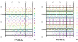
Novel reality capture technologies like terrestrial laser scanning are becoming a common sight on construction jobsites and operational facilities. Yet, Planning for scanning (P4S) -- i.e. the process of selecting the number, locations of laser scans and registration targets –- is still done quite subjectively by surveyors, which could lead to the acquired data being of insufficient quality or completeness for its purpose (e.g. Scan-to-BIM or Scan-vs-BIM applications).
With the growing use of Building Information Modelling (BIM) for the construction and management of the built environment, this project aims to deliver a novel, scientific and general approach to P4S. By delivering scanning plans that are not only efficient (minimising the amount of scanning required) and ensuring that the subsequently acquired data fits its intended purpose, our system enables the industry to ensure reliability, save data storage, time and ultimately money.
Academic Publications
| Year | Authors, date, title and journal | web | |
|---|---|---|---|
| 2025 | Duraimany, T. and Bosché F. (2025). Automated Planning, Execution, and Re-planning of Terrestrial Laser Scanning in the Built Environment. Building Digital Twin Scientific Conference. Kaunas, Lithuania. | web | |
| 2021 | Aryan A., Bosché F., Tang P. (2021), "Planning for Terrestrial Laser Scanning in Construction: A Review", Automation in Construction, Vol. 125, 103551. | web | |
| 2015 | Biswas H. K., Bosché F., Sun M. (2015), "Planning for scanning using building information models: a novel approach with occlusion handling", 32nd International Symposium on Automation and Robotics in Construction (ISARC), Oulu, Finland, June 15-18. | web |


